-

Optitour
MIS: Multimodal Information System
OptiTour
Multimodal Information System
New generation mobility
Optitour allows you to calculate your trips in a few clicks, presenting you with the most efficient transport solutions for your journey.More than an application for mobility, Optitour is a global solution that allows territories and public transport professionals to support their users during their travels. Thanks to the multimodal management and statistics platform, offer the best to your users while measuring in real time the transport activity of your territory.
Features
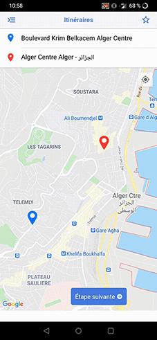
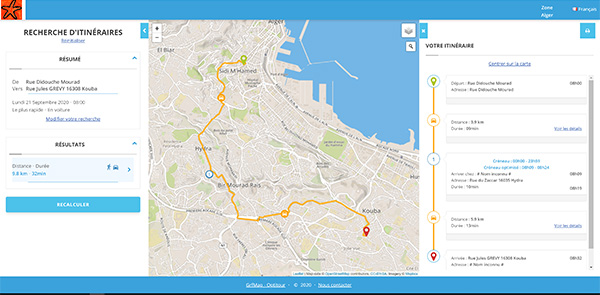
Multimodal trip planner
Optitour calculates the optimal journey according to your choice of schedule and mode of transport, by combining public transport (municipal bus network, departmental network, regional road and rail network), cycling, and car in addition to public transport.
Statistics
Discover the most frequented places and axes, the routes taken, the peak hours.
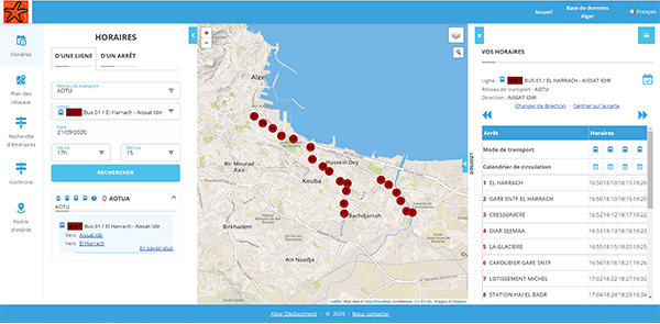
Consulting the hourly data of the public transport network
Optitour provides access to all information on lines, timetables and services of the public transport network. There is also information on travel to other agglomerations in the metropolitan area:
- The "Traffic information" alerts page
- Map of public transport lines (bus-metro-subway, etc.)
- Detailed timetables (bus-metro-subway ...)
Route planning and optimization
Optitour integrates a tour planner that allows you to:
- Optimize delivery, distribution and collection routes
- Optimize the use of your fleet
- Reduced transport costs
- Organize, control, optimize and develop your operations
Offline mode
A trip abroad and you want to preserve your connection? Prepare and save your trip to enjoy your visit offline.
Guide mobility
Facilitate the discovery of your territory by limiting or favoring certain axes or certain means of transport.
Geolocated push messages
Send messages to your users based on their location. You set the zone, the message and a notification automatically appears when it arrives.
Application areas
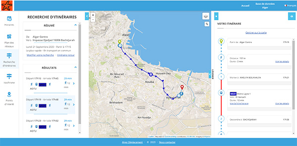
Multimodal trip planner
Optitour calculates the optimal journeys according to your choice of schedule and mode of transport, by combining public transport (municipal bus network, departmental network, regional road and rail network), cycling, and car in addition to public transport.
Consulting the hourly data of the public transport network
Optitour provides access to all information on lines, timetables and services of the public transport network. There is also information on travel to other agglomerations in the metropolitan area:
- The "Traffic information" alerts page
- Map of public transport lines (bus-metro-tram, etc.)
- Detailed timetables (bus-metro-tram ...)
Route planning and optimization
Optitour integrates a tour planner that allows you to:
- Optimize delivery, distribution and collection routes
- Optimize the use of your fleet
- Reduced transport costs
- Organize, control, optimize and develop your operations