-

GrfMap
Interactive mapping solution
GrfMap
Geographic information creation and dissemination solution
Independent but still compatible with the GIS of the market, GrfMap is a powerful and economical solution for the creation and publication of georeferenced vector data on the intranet or on the Internet.
What are the benefits of using GrfMap?
Companies and organizations generally tend to place their trust in the "big guys" in the market by thinking of minimizing their risk taking and covering their present and future needs. This approach, although legitimate, however, leads to many disadvantages, the first of which is the creation of a dependence on tools that are increasingly complex, expensive and ultimately far removed from the initial need.
GrfMap is compatible with market standards and allows you to regain control of what makes your expertise valuable: your data and your processes.
The many benefits of GrfMap are notably:
- Independence
- Acquisition and possession price
- Innovative and efficient
- Compatible with market standards
- Inspired and compliant
Maps and statistics
Features
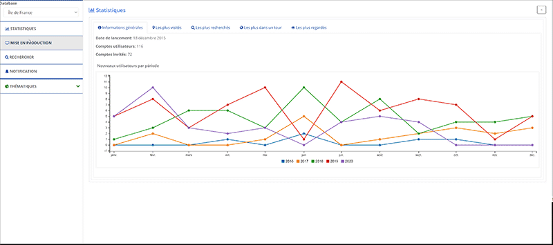
Dynamic thematic analyzes
Thematic analyzes by value classes or by individual values are represented by pie charts, histograms, sea urchins and / or classification. Data analysis can focus on one or more fields and involves the generation of a thematic layer. This representation is dynamic: it is updated if the value of a field is modified. Thematic layers can contain conditions to facilitate their customization.
Creation of isochrones and route calculations
GrfMap Incorporates a route calculator which makes it possible to visualize, analyze and understand the impact of travel and accessibility to places, taking into account the distances and travel times. GrfMap is particularly useful for creating catchment areas, isochrones, for optimizing routes and therefore responding to location and logistics needs.
Compatible with standards
It knows how to interact with most of the databases on the market: SQL Server, Oracle, MySQL, PostgreSQL. Geographic data can be integrated from the main GIS standards on the market (Shapefile, MapInfo TAB and MapInfo MIF / MID).
Fleet tracking, GPS tracking
TransTools' fine-grained user management system makes it easy for partner organizations to access subsets of TC data streams that they need read, write, or administrator access to. Multi-carrier TC data flow.
Application areas
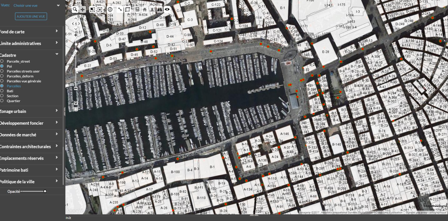
Orus, land deposit
Allows the massive identification of land deposits, their constructible potential and their availability
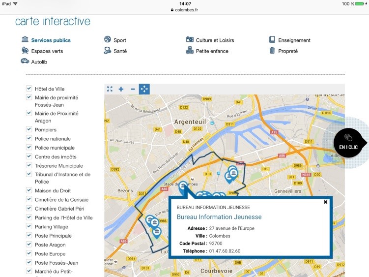
Interactive map
Tourist information site for the city of Colombes
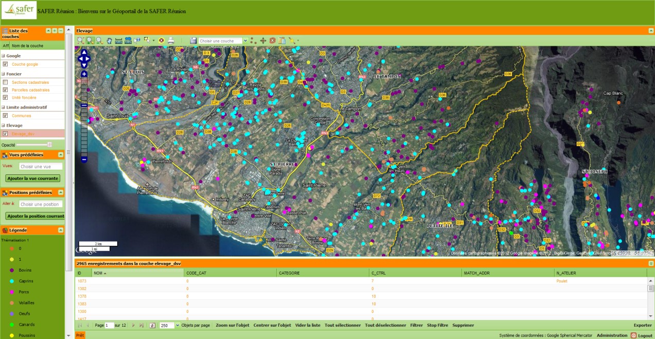
Safer website - Reunion Island
Topology management with line-of-business applications